
The highway was opened to the public in 1948. Legendary over many decades for being a rough, challenging drive, the highway is now paved over its entire length.
An informal system of historic mileposts developed over the years to denote major stopping points; Delta Junction, at the end of the highway, makes reference to its location at "Historic Milepost 1422." It is at this point that the Alaska Highway meets the Richardson Highway, which continues 96 mi (155 km) to the city of Fairbanks.
North To Alaska ~ Johnny Horton
---------------------------------------------------------------
Alaskan tie (engl. Alaska Highway) on Dawson Creekistä (Brittiläinen Kolumbia, Kanada) Delta Junctioniin (Alaska, Yhdysvallat) johtava tie, joka rakennettiin toisen maailmansodan aikana 1941–1942. Se on 2 451 kilometriä pitkä.
Tie kulkee muun muassa Whitehorsen (Yukon, Kanada) kautta.
Tie rakennettiin yhdistämään Alaskaan rakennetut lentokentät, joita käytettiin Lend-Lease-avun toimittamiseen Neuvostoliitolle.
Rakentamiseen vaikutti myös pelko Japanin mahdollisesta maihinnoususta Alaskaan. Alaskaan ei olisi ilman tietä millään saatu tarpeeksi nopeasti joukkoja sitä puolustamaan. Suunnitteilla oli myös jatko Nomeen Beringinsalmen rannalle.
Yhdysvaltain asevoimat rakensi tien käyttäen pääasiassa afroamerikkalaisista koottuja rakennuskomppanioita, joiden epäiltiin aluksi olevan kykenemättömiä näin vaativaan tehtävään.
Tie avattiin siviililiikenteelle 1948 ja on kokonaisuudessaan päällystetty ollen auki ympäri vuoden.
---------------------------------------------------


Caterpillar D7

This is often regarded, though unofficially, as the northern portion of the Alaska Highway, with Fairbanks at Historic Milepost 1520. Mileposts on this stretch of highway are measured from Valdez, rather than the Alaska Highway. The Alaska Highway is popularly (but unofficially) considered part of the Pan-American Highway, which extends south (despite its discontinuity in Panama) to Argentina.
The attack on Pearl Harbor and beginning of the Pacific Theater in World War II, coupled with Japanese threats to the west coast of North America and the Aleutian Islands, changed the priorities for both nations.
On February 6, 1942 the construction of the Alaska Highway was approved by the United States Army and the project received the authorization from the U.S. Congress and Roosevelt to proceed five days later. Canada agreed to allow construction as long as the United States bore the full cost, and that the road and other facilities in Canada be turned over to Canadian authority after the war ended.
The official start of construction took place on March 8, 1942 after hundreds of pieces of construction equipment were moved on priority trains by the Northern Alberta Railways to the northeastern part of British Columbia near Mile 0 at Dawson Creek. Construction accelerated through the spring as the winter weather faded away and crews were able to work from both the northern and southern ends; they were spurred on after reports of the Japanese invasion of Kiska Island and Attu Island in the Aleutians.
-----------------------------------------------------------------------------------
Road Construction Mountainous Country
Road Construction 1943 Northen Territory
--------------------------------------
Burma Road Constructions
--------------------------------------
Within the context of the entire Second World War, perhaps the only two comparable engineering projects were the constructions of the Alaska Highway and the Burma Road – both of which came well after the construction of the later Petsamo Highway (Pechenga Linakhamari - Tornio), built in 1940, while a major engineering feat, was based on an existing highway and while it was completed rapidly in light
----------------------------------------------------------------------------------------

Gradall, (1944) around rotating excavator, truck frame mounting.
The first fully hydraulic excavator, with double acting cylinders, push-pull action.
Linn truck chassis, use later six-wheeled GMC army truck.
Hydraulic cylinder
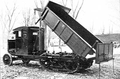
Linn truck, normal civil work version

Linn C5 army version, Track-Wheel system, crane and trailer.
----------------------------------------------
During construction the road was nicknamed the "oil can highway" by the work crews due to the large number of discarded oil cans and fuel drums that marked the road's progress. On September 24, 1942 crews from both directions met at Mile 588 at what became named Contact Creek, at the British Columbia-Yukon border at the 60th parallel; the entire route was completed October 28, 1942 with the northern linkup at Mile 1202, Beaver Creek, and the highway was dedicated on November 20, 1942 at Soldier's Summit.
The needs of war dictated the final route, intended to link the airfields of the Northwest Staging Route that conveyed lend-lease aircraft from the United States to the Soviet Union. Thus the long, impractical route over difficult terrain was chosen.
The road was originally built mostly by the U.S. Army Corps of Engineers as a supply route during World War II. In 1942, the Army Corps of Engineers assigned more than 10,000 men, about a third were black soldiers, members of three newly formed "Negro regiments". There were four main thrusts in building the route: southeast from Delta Junction, Alaska toward a linkup at Beaver Creek, Yukon; north then west from Dawson Creek (an advance group started from Fort Nelson, British Columbia after traveling on winter roads on frozen marshland from railway stations on the Northern Alberta Railways); both east and west from Whitehorse after being ferried in via the White Pass and Yukon Route railway. The Army commandeered equipment of all kinds, including local riverboats, railway locomotives, and housing originally meant for use in southern California.
Although it was completed on October 28, 1942 and its completion was celebrated at Soldier's Summit on November 21 (and broadcast by radio, the exact outdoor temperature censored due to wartime concerns), the "highway" was not usable by general vehicles until 1943. Even then there were many steep grades, a poor surface, switchbacks to gain and descend hills, and few guardrails.
Bridges, which progressed during 1942 from pontoon bridges to temporary log bridges, were replaced with steel bridges where necessary. A replica log bridge, the Canyon Creek bridge, can be seen at the Aishihik River crossing; the bridge was rebuilt in 1987 and refurbished in 2005 by the Yukon government as it is a popular tourist attraction. The easing of the Japanese invasion threat resulted in no more contracts being given to private contractors for upgrading of specific sections.
Some 100 miles (160 km) of route between Burwash Landing and Koidern, Yukon, became nearly impassable in May and June 1943, as the permafrost thawed, no longer protected by a layer of delicate vegetation. A corduroy road was built to restore the route, and corduroy still underlays old sections of highway in the area.
Modern construction methods do not allow the permafrost to thaw, either by building a gravel berm on top or replacing the vegetation and soil immediately with gravel. The Burwash-Koidern section, however, is still a problem as the new highway built there in the late 1990s continues to experience frost heave.
Pincers on Japan and Look to the North both 1944 productions were National Film Board of Canada documentaries that depicted the construction of the Alaska Highway.
In 1993 Brian Corntassel and Tony Leonard of HW Lochner Inc, Chicago Civil Engineers proposed the Juneau Access Project through the Taku River valley into Canada and from Juneau up the West Lynn canal Juneau to Haines, Haines to Skagway and Taku River route Juneau to Atlin BC with 13 Ferry Transportation, 94 bridges and 17 Glacierial Tunnels for ADOT&PF. The plans were documented in metric units for the Canadian portion of the design, drawn in standard then computer files were scaled and matched together perfectly at demonstration.
The EPA enforced cooperating with the design to avoid all American eagles nests and Native American Brian Corntassel represented the Birds natural habitat and highway plans simultaneously through the projects successful completion.
Ei kommentteja:
Lähetä kommentti
Any explosive ammunition or empty cores, you can put in this.